Properties
Peg North Lithium Project

Washington is increasingly viewing Canada as a kind of “51st State” for its critical mineral supply needs and plans to deepen financial and logistical partnerships with the country’s mining sector ”
According to a U.S. government source 
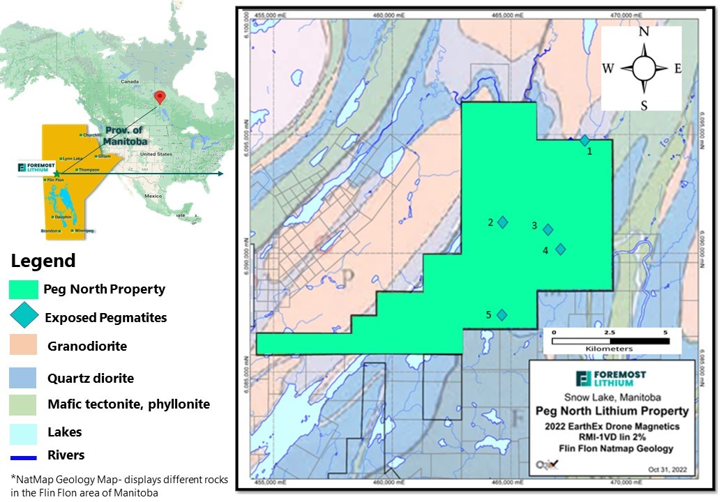
Foremost Lithium’s Peg North Project is in the historic mining district of Snow Lake, Manitoba and consists of 16,697 acres (6,757 hectares) or approximately, 26.4 square miles. The Property is located at the east end of the Flin Flon-Snow Lake greenstone belt. The Paleoproterozoic Flin Flon-Snow Lake Belt is approximately 200 km in strike length and has an exposed width of up to 70 km.
The Peg North Claims consist of 28 claims with 5 pegmatite dykes first mapped and reported by Murray Frarey, a Geological Survey of Canada geologist, in 1949. The property straddles the northeastern extension of the Crowduck Bay Fault, which is a focal point for the development of lithium-enriched pegmatite dyke clusters.
The Peg North Claims is the company’s largest property and was acquired by option agreement in early of June 2022, the company greatly expanded its footprint in the Snow Lake area to an amalgamated 43,276 acres (17,513 hectares) in the highly prospective Snow Lake pegmatite fields, including the entire northern extension of the Crowduck Bay Fault.
EXCELLENT POTENTIAL
- The Peg North claims include the northeast extension of the Crowduck Bay Fault (CBF). A study of the distribution of the numerous pegmatite dykes adjacent to the Crowduck Bay Fault (CBF) was documented and reviewed by (Cerny et. al 1981) and further identify the CBF as a focal point of exploration interest for lithium pegmatite in the Snow Lake pegmatite fields. 1
- Additional lithium-bearing pegmatites occur northeast, east and southeast of the Peg North property and underscore the highly prospective nature for repetitions of lithium-earing pegmatite dykes.
- The property is accessible for year-round drilling
EarthEx Geophysical Solutions Inc undertook a UAV-borne (unmanned assisted vehicle) magnetic survey over the entire property in 2022. The survey was conducted between June 15th, 2022, and October 6th, 2022, and comprised 2990.5-line km, and identified numerous areas of interest worthy of follow-up ground exploration.
UAV magnetic data lends itself very well to finding new prospective drill targets. The UAV system's resolution has provided excellent litho-structural detail over all Foremost's Lithium Lane properties and has generated detailed 3D models of the magnetic sources on the properties. Magnetic surveys can provide valuable exploration information such as depth to source, dip of the body as well as the overall shape and morphology of the lithological unit.
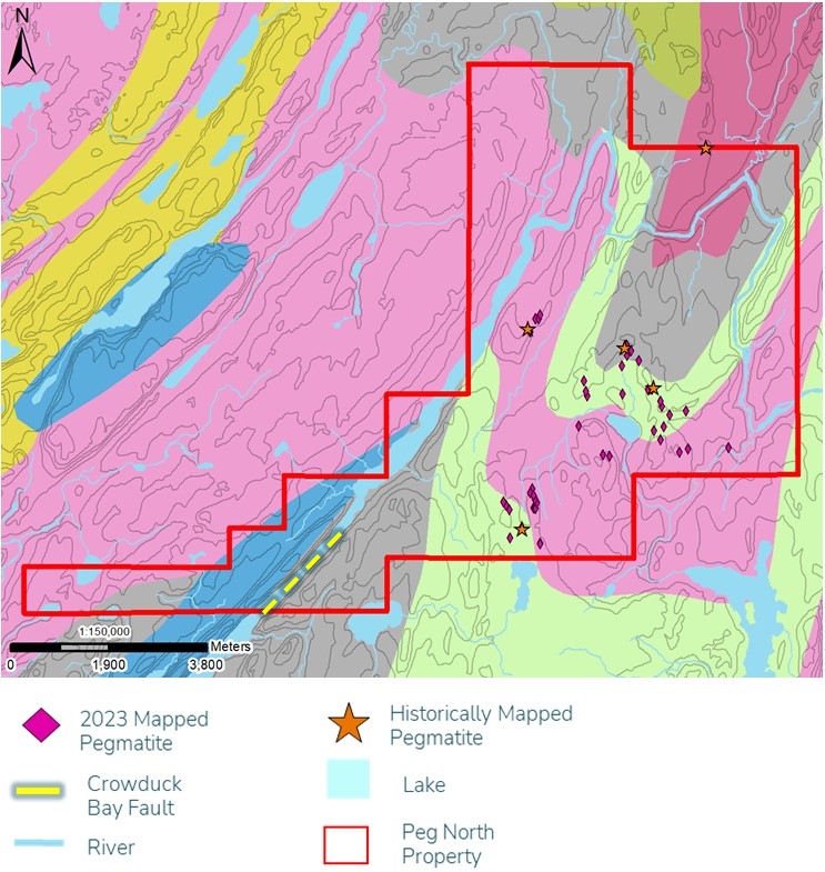
Figure 2: Peg North property, Snow Lake area
Summer and Fall Exploration
Dahrouge Geological Consulting undertook a summer exploration campaign with crews in which a high volume of pegmatite dykes were discovered during the 2023 field campaign. Significant unexplored territory highlights the prominence of the Crowduck Bay Fault.
The Company announced that LiDAR survey commenced in the first part of October on the Peg North claim block to complete the collection of LiDAR and high-resolution magnetics over the entirety of its Lithium Lane properties in the Snow Lake area. A high-resolution LiDAR models of ground elevation or relief on the Lithium Lane properties have also defined many areas with comparable orientations as known spodumene-bearing pegmatite.
Forward Moving Plans
Future plans include extensive prospecting and exploration as the previous exploration was largely limited due to accessibility issues as forest fires inhibited access to a large portion of the property. Both magnetic discontinuities and LiDAR images, once complete, with appropriate orientations, coupled with mapping, geochemical survey, and the magnetic survey will provide a base to follow-up exploration and drill targeting.
QP STATEMENT
Technical information relating to information contained on this property’s page has been reviewed and approved by Dr. Mark Fedikow, P.Geo. who is a Qualified Person as defined by NI 43-101.
Data Source
1: Cerny, P., Trueman, D.L., Ziehlke, D.V., Goad, B.E. and Paul, B.J.: 1981: The at Lake-Winnipeg River and the Wekusko Lake Pegmatite Fields, Mantoba; Manitoba Department of Energy and Mines, Mineral Resources Division, Economic Geology report ER80-1, 215 pages.